Saturday, June 8, 2024

Arriving to The Last Frontier - ALASKA (Sunday 5/19)

In planning for this great adventure, it was difficult to really know what the best utilization of time would be.  While we had booked the campervan for 18 days, Pam only had 14 to spend on the trip.  As I commented on an earlier post, getting through the lower 48 quickly was a priority, so as to have a maximum amount of time for Canada & Alaska . . . but with the biggest effort to get in as much as possible with Pam in Alaska.  I think we did a great job navigating through Canada, enjoying the sights and views, while allowing ourselves a full week for Alaska.

Our arrival on Sunday afternoon was a full day and a half later than we had initially planned for, making it impossible to include the drive north of Fairbanks to the Arctic Circle.  We had started discussing that as a possibility on Friday, so when it was time to punt, we were both prepared to maximize our time enjoying Fairbanks before we were scheduled to arrive at Denali National Park and our TEK campground on Tuesday afternoon.

Because we didn't know what day we would be arriving to Fairbanks, we did not make campground reservations.  We had also initially planned on camping on BLM land up on the Yukon River if we had made the trip to the Arctic Circle.  So arriving into Alaska, one of our first priorities was finding a campsite.  This proved to be a bit more challenging and frustrating, but I'll talk more about that shortly.

As expected the Alcan Hwy from the Canadian border to Tok, AK was under construction.  We experienced roughly an hour delay in the one-lane pilot car led procession.  It wasn't terrible . . . just slow.  It's good that they do the best they can to repair the road before their real summer season of tourist traffic begins after Memorial Day.  As you can see here, there were plenty of vacationers already on the road heading to the great north.

At Tok we stopped for "cheap gas" ($4.38/gallon), when you consider gas in Canada averaged just over $5.00/gallon (adjusted from liters to gallons and CD$ to US$)
Across the street from the gas station, we saw 5 of the GAH/SAP Minnie Winnies arrive at the TOK RV Village.  It was cool to cross paths with them several times throughout our journey as we had seen them all stopped in Beaver Creek, YT earlier in the morning . . . and would see them again a couple of days later at a Talkeetna RV park.

At Tok, we opted to take the longer route up to Fairbanks, as in my opinion the Richardson Highway from Glennallen up to Delta Junction is one of the most beautiful drives in all of Alaska.  So we dropped down onto the "Tok Cutoff" adding roughly 90-100 minutes to our drive time.  We knew cloudy weather was in the forecast, which would make viewing the beautiful glaciated area, including the Gulkana and Black River Glaciers, questionable.  What we didn't consider was that snow might be possible, especially in higher altitudes and across the mountain passes.  It was beautiful though, and we enjoyed driving in a winter snow globe throughout the afternoon!

As evening approached, we stopped at the Meier's Lake Roadhouse . . . an oasis on the landscape where Pam couldn't wait to get a fresh cup of coffee! We spent about an hour there, enjoying conversation with the owner hearing about the history of the area, including her roadhouse and the church across the street.  She invited us to go inside the church, which was very interesting.


A bit further up the road, the massive Alaska Pipeline made its appearance along the highway.  In spite of the cold and snow, we stopped to take a look and a few photos.  I assured Pam we would have better opportunities to see the pipeline up close in Fairbanks so we rolled on up the road.


Every stop we made this evening was in spite of the chilly winter weather.  Even a stop in Delta Junction . . . the end of the Alcan Highway . . . was brief for this reason.  But we did not let the weather deter us from doing our thing and take photos!


Check out the lovely sunset @ 10:30pm just north of Delta Junction!  The skies were trying to clear as we made our way closer to Fairbanks.

Earlier in the day we had made a campsite reservation at the RV park located at the Fairbanks fairgrounds.  While we were told their showers were not operating yet, we were led to believe there were functional toilets available to guests.  When we arrived around 11:30pm, however, we found the toilets locked and we did not have the access code to use them.  With the camp hosts in bed and asleep, there was nobody around to help us . . . so we opted to move on and find somewhere else to stay.

After driving around town looking at a couple of sketchy places found online, we decided to bite the bullet and pay a premium price at an RV resort that had full amenities including running water (toilets and showers).  While I hated paying $72/night (which included a 10% Good Sam's discount), we felt we didn't have much of a choice.   That said, the Rivers Edge RV Park was safe, clean and convenient to our day's activities on Tuesday . . . so no regrets in booking there for two nights (Sunday & Monday).

TO BE CONTINUED - FAIRBANKS!

Friday, June 7, 2024

More of Canada - The Cassiar to the Yukon & Beyond (Friday 5/17 - Sunday 5/19)


We woke up on Friday morning to early morning fog in the Witset RV Park & Campground near Moricetown, BC.  We were fortunate to find this place as we struggled after Prince George to find a decent campground.  This place fit the bill as it was clean and had decent bathrooms/showers.  After showers and breakfast, we were out of camp shortly after 8:00am.

Leaving camp took us over an old wooden bridge crossing the Bulkley River and Canyon.  Both Pam & I commented the night before as darkness fell, that we wanted to take photos the next morning.  Thankfully the skies had cleared and the sun was bright.  Here I am ready to take on the day!


Our first impromptu stop of the day was here at the old village of Hazelton, the oldest surviving village in Northern British Columbia.  About 5-7 miles off of Hwy 16, before we got to the Cassiar Hwy.  We drove through town and then stopped here at what is now the Municipal Building.  A replica of a 19th century era river boat, many of the parts are from original paddlewheelers from that time.


Also nearby is the 'Ksan Historical Village & Museum.  Too early in the season, it was closed so all we could do was drive through and look at some of the buildings on the grounds.  Perhaps worthy of being placed on our "next time" list.

This is the Hwy16/Hwy 37 junction where the Cassiar Hwy heads north to the Yukon.  It is also possible to continue on southward to a remote area of Alaska, but we didn't feel the need to linger or detour.  So this would be our fuel stop, before heading deeper into the wilderness and the unknown in terms of where we might find our next gas-up opportunity.  Most advise to never let your gas tank get below half a tank, as fuel stops are not always reliable in this part of Canada.  Also adding to the uncertainty, was the fact that with the Alcan Hwy closed due to the wildfires near Ft. Nelson, all traffic to Alaska had to take the Cassiar Hwy, creating a significant increase in demand in fuel plus reported capacity situations at campgrounds along the way heading up to Watson Lake.  These were concerns we did not take lightly!


While the road was remote, it was in great shape!  We had read about frost heaves and potholes on a variety of online resources, but found the drive to be comfortable and interesting.  We did drive miles and miles (or perhaps more appropriately . . . kilometers and kilometers) without seeing much in the way of other drivers or towns along the way.  There were ample turn outs to stop to rest, many with vault toilets, so were were good.

The village of Gitwangak is just a few miles north of the 16/37 junction, and has several totem poles.  While interesting, this isn't really developed as an attraction, leaving us to ponder the significance of the totems on display here.  That said, being early in our adventure and our first chance to see totems up close, we enjoyed our stop . . . again a great opportunity to get out and walk a bit.

As we were leaving the area, we met these fellow GAH/SAP folks in their Minnie Winnie.  They were very nice and willing to pose for a quick photo for inclusion in this blog and to share with the GAH/SAP Facebook Group.  It was pretty remarkable that with 157 units out on the road traversing from Iowa to Anchorage, we would literally run into others along the way . . . especially given as vast and remote so much of the trip is.

Here's a bit of what it looked like for us as we continued north on Hwy 37, the Cassiar Hwy.  The 2-laner often followed along a river or through the valley alongside the tall snowcapped mountains.  Because of the density of the forest, it was often impossible to see (and photograph) wildlife.
As you can see here, Simmons Lake in British Columbia was still mostly iced over.  While we had initially considered boondocking here, we decided to move on as there were other places expected ahead.  We did buy a package of homemade english muffins at this "honor box" hanging in the turnout.  They were delicious for breakfast the next morning . . . and a couple of days later too.
We had no idea this area was known for their jade mines.  When we passed through here around 9:00pm, we saw several GAH/SAP campers boondocking here.    Everyone seemed on top of one another, so we pushed on another half an hour for our overnight spot.

The Tā Ch’ilā Park/Boya Lake Provincial Park was where we landed!  It was $20CDN for a dry campsite, which was also very close to the vault toilets.  As you can see, we had a great site, right along the lake.  And the mosquitoes were not out yet . . . BONUS!


We woke up and hit the road for Watson Lake, home of the world famous Sign Forest.  While it required a bit of back-tracking on the Alcan Hwy, with was worthwhile to visit and add our own personal signs to the collection.  Mine was an old license plate from the '66 VW Beetle I had bought for Pam back in the mid 1980's.  She added a special tribute item in honor of her husband Rex.

Once back on the road, we had chef salads for lunch.  Being able to pull off the road and enjoy a a great view over a meal is one of the benefits of RVing.  We ended up over-nighting Saturday night at the Congdon Creek Provincial Park near Destruction Bay . . . another $20CDN/night dry campsite with vault toilets near by.


And check out the snow/sleet we drove through on Saturday afternoon!  It was not slippery, but did add an element of caution for about an hour.


We rejoined the Alcan Hwy at Watson Lake, YT.  The road from there to Whitehorse was in great shape, but beyond that . . . from Destruction Bay to the Canada/US border . . . not so much.  This is just an example of how tore up the road is from their arctic winters.  The tundra creates frost heaves, that really damages the roads and driving taking a high level of attention and caution to avoid damaging tires and the undercarriage.

As we saw, there are big highway projects to make the roads better.  I imagine it's a very short construction season in this area of Canada and over in Alaska too.
We reached the Canada/USA border Sunday around 12:00pm.


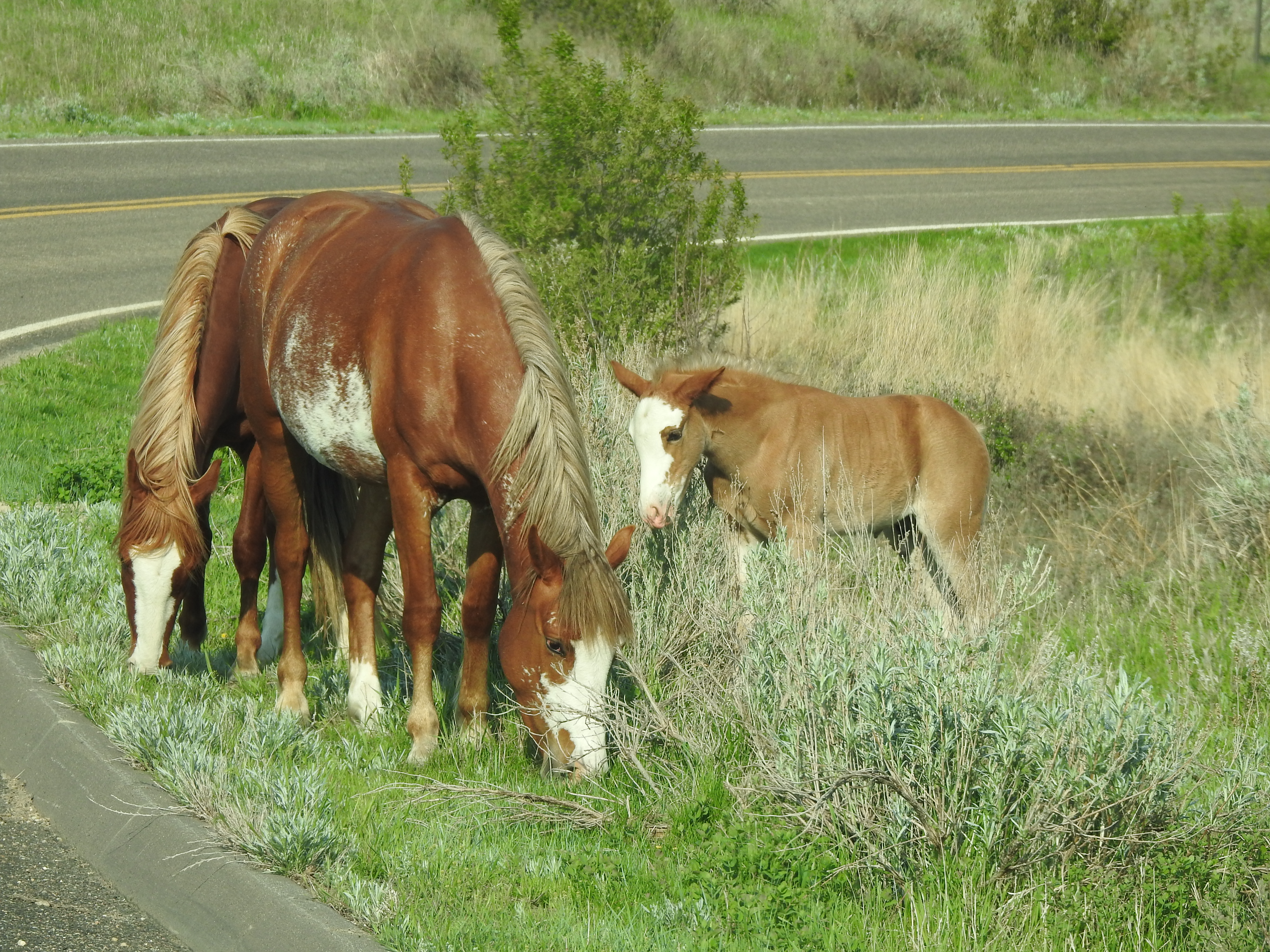
Before wrapping up this segment of our trip, here is a bear video and a few photos of the wildlife we encountered on these days.  There were a lot more, but stopping safely to photograph them, is a real challenge.  Sometimes you have to just slow down and enjoy the view while they allow you to be in their company.  Many of the animals (black bears and moose especially) were skiddish and smartly darted into the forest when cars approached.


A big brown/grizzly bear.  S/he didn't seem to give us any attention, only looking up from time to time while foraging in the dirt.
This was a family of black bears.  The momma is the one on the upper right.  Her two cubs appear to be almost as big as she is, so I'm guessing maybe 2-year olds?  The one in the foreground is a cinnamon colored bear and was lighter than its darker sibling.

This was one of the saddest bear experiences we had on the trip.  This black bear was with several others just outside of Dease Lake, a well known tourist area on the Cassiar Hwy.  When we pulled up and out onto the shoulder, this bear started right towards our camper!  THIS IS NOT APPROPRIATE BEAR BEHAVIOR!!! It only occurs when a bear has been habituated to humans because they are used to being fed.  NOT GOOD!  A fed bear is a dead bear because they almost always become nuance bears, and euthanized for the safety of people.

TO BE CONTINUED  - BACK IN THE USA!

Kootenay, Jasper & Banff National Parks (Tuesday 5/14 - Thursday 5/16)

Our original plan was to make it to a prebooked campsite at Whistlers in Jasper National Park by nightfall on Tuesday 5/14.  With all of the stops we made in the lower 48, however, this had become an impossibility.  We knew there was a good chance we'd need to make audibles along the way, and this one was definitely worthwhile as we didn't want to be driving through this beautiful region of national parks after dark.  We kept saying that all of the amazing things we were experiencing made it worthwhile, even if it meant not staying at a campsite we had already paid for in advance.  In this case, we were talking about around $40 so really not a big deal at all.

Kootenay National Park and its Radium Hot Springs were also on my radar, but initially didn't seem to be in play given our aggressive schedule to get to Whister Campground in Jasper National Park.  With that not in play, Kootenay was definitely worth trying for . . . which is exactly what happened.  We arrived to the Redstreak Campground in Kootenay National Park around 8:00pm.  With plenty of vacant campsites, we pretty much had our pick of spots near the bathroom & showerhouse.  Awwwww, how great a hot shower was going to feel in the morning!

SIDEBAR:  While the Solis campervan had a bathroom with canister toilet and shower, we opted to not deal with any of the water systems out of brevity and potential lack of patience.  This early decision made it important for us to find campsites with at a minimum, vault toilets.  Running water and showers were a bonus!  It also meant that boondocking (aka dispersed or dry/remote camping) would not be an option, adding expense for campsites for all 18 nights of our adventure.  All tolled, it added around $300 in added expense to our trip . . . frankly well worth it in my opinion.

In the morning we had hoped to be able to stop at the Radium Hot Springs for a short swim, but unfortunately they were still on pre-season hours and not scheduled to open until 11:30am.  Not wanting to lag around for the morning, we said "Something for next time!" and moved on.

We knew all of our "in the moment" options and decisions would work out, as everything we were doing was new and amazing.  So with by-passing the hot springs, next on our agenda was finding a local bank to exchange some US money into Canadian cash.  With our arrival after hours the night before, and knowing that local telecom systems might make paying by credit card a challenge, plus needing cash to pay for local/provincial park campsites, we were going to need some local money.

This became the first real hassle of the trip, adding some stress as the town of Radium Hot Springs didn't seem to have a bank with hours convenient for us, but we figured there would be plenty of opportunities later in the day.   WRONG!


Our next attempt in Lake Louise was a colossal waste of time!  As best we could figure out, an ATM in a hotel was the closest thing to a bank we'd find.  Using TOOTS (our Garmin GPS), we found that Banff had banks, but they were more than an hour "back" but we felt we had no other options, so back we went.

We quickly learned that getting cash was going to be more difficult than expected.  At the RBC Royal Bank, they would not do the exchange for non-customers.  So we ended up having to go to a local exchange desk inside of a jewelry store in the mall.  Paying a premium for the privilege of getting local currency, it was a case of live and learn.

Once we had our money situation taken care of, we enjoyed our short drive around Banff and a quick stop for sandwiches before heading out for Jasper.  The views and wildlife were remarkable, often impossible to stop and take photos.  But here's a sampling of what we saw during our time on Wednesday 5/15.

I had never seen a green lake with green ice before.  This was in the Valley of Five Lakes.

A very pregnant rocky mountain sheep - she looked like she was going to drop at any moment.
Bear jam with lots of people milling around to watch (and photograph) a big black bear who was just laying on the side of the road.  We couldn't see that it was injured, but it just didn't seem right.  Maybe it was tired?

Near the Radium Hot Springs in Kootenay National Park - rocky mountain sheep.


We did drive through the Icefields Parkway as we headed up to our campsite for the night.  The weather was marginal at best, with rain and low hanging clouds and fog.  The view of the world renowned glaciers was less than impressive.  Another place for the "next time" list.

This short video is of the Tangle Creek Waterfalls, seen on the Icefields Parkway.  It was one of the few visible and safely accessible from the road.


Since we didn't make it to Whistlers Campground the night before, and timing was such, we opted to stop there for Wednesday night.  It was a nice enough place, with decent views and amenities.  We enjoyed watching the elk as they sauntered through our site late in the evening.  She too looked very pregnant and ready to drop at any moment.

The next morning we were up relatively early and out by 8:30am.  We would head from Jasper to Prince George, where we would make the detour from the Alcan Hwy to the Cassiar Hwy due to the fires up around Ft. Nelson, BC.

It was still chilly and rainy, but we stopped at Mt. Robson Provincial Park to enjoy the views and take in some of the exhibits in their visitor center.  It is the second oldest provincial park in British Columbia and has the tallest mountain peak in all of the Canadian Rockies.  It was well worth our time to stop and stretch our legs!

As we were heading out of Prince George, we found ourselves behind another GAH/SAP Solis making the trek to Anchorage.  It was fun to see others on our same journey on the road.  According to GAH, there were 157 RVs and campervans traveling from Iowa, all of whom started the same weekend as us.

I think we crossed paths with around 5-7 others on the road in Canada and Alaska.  It was always cool to see them and wave!

TO BE CONTINUED

Thursday, June 6, 2024

RV2AK Through the Lower 48 (Sunday 5/12 - Tuesday 5/14)

As much as I had wanted to blog every few days while on the road, it simply was not possible.  We had very limited phone capabilities and zero Wi-Fi throughout our trip.  So here I am starting to blog now that I've been home a few days.

Our trip from Milwaukee on Saturday 5/11 was uneventful, allowing us to start bright and early at the Winnebago Fairgrounds in Forest City, IA.  Here we are getting settled into our 2025 Solis campervan.  David was a great help in getting all of our supplies and clothes moved over.  We were ready to hit the road by 9:30am with our first planned campground booked some 700 miles away at Theodore Roosevelt National Park (TRNP) near Medora, ND.  This would end up being our longest single day of travel as it didn't take long for "the game plan" be interrupted by places to explore along the way. Day #2 (Monday 5/13) from TRNP was suppose to have us traveling 785 miles to arrive at Eureka, MT Monday night for an early Tuesday morning crossing into Canada, but that didn't happen.  More on that later!

Once on the road from Iowa, we hustled through Minnesota with a gas and Wal-Mart stop for some last minute provisions.  After that, there wasn't much more to talk about other than the goal of arriving to our campsite at TRNP by nightfall.  Yeah . . . that didn't happen either. LOL

We did enjoy a delicious bowl of chili, which David had premade for our trip.  The early part of this adventure was made more convenient thanks to several prepared & frozen meals David made for us!  As you can see in the photo, it was already close to dark when we stopped at Sweetbriar, ND for supper.  Fortunately, I'm very familiar with the Cottonwood Campground inside TRNP, so we were able to find and settle into our campsite even through it was 11:00pm and totally dark.  Morning came early, after a good night's sleep . . . we were up and on the park road by 6:30am to see what wildlife might be around.

It didn't take long for us to see bison and prairie dogs . . . but I was really hoping we'd see the wild horses this park is known for.  Often they are off far away in the badlands or grazing out on the prairie not accessible unless you are willing to get out and hike a bit.  We had neither the time nor inclination to go for an off-trail hike, so we had our fingers crossed.  Our patience (and wishes) paid off when we got to spend some time with Dolly and her recently born colt Lonestar. We also saw a couple of bachelor stallions who were not part of any band at the time.


After time with this small family, we headed out to the visitor center and Theodore Roosevelt's Maltese Cross Cabin at the park entrance.  It was already noon when we finally got back on the road, heading west for Montana.  It was becoming clear we would be spending a lot more time getting from point A to point B given our interests and taking the time to explore along the way.  Both Pam & I were good with this, knowing that part of the adventure would be the things to see along the way.  I also knew that our routing through Montana was set up to provide opportunities for me to share places I had visited during my summer of living in Yellowstone and enjoying the history Montana provides from a bygone era.

It was nice being able to log some high speed miles through Montana.  With their 80 mph speed limit, I was hoping we'd make up some time.  But it wasn't all that great especially with the high winds and tall profile of the campervan.  Speaking of the height of the camper . . . we quickly learned that short girls have issues when it's time to do routine tasks like cleaning the windshield!  During one gas stop in Montana we met a nice young couple Allison & Eric.  He was tall and lanky, and offered to do our windshield for us.  I couldn't help to sound old when I thanked him with a "bless your heart."  We ran into them later in the day at a rest area overlooking the Yellowstone River just before Billings.  We enjoyed lunch, and even offered them a sandwich but they had already eaten and were continuing on to Bozeman.

As we passed through Billings, I suggested we needed to start thinking about where we'd want to stop for the night as clearly Eureka was not possible.  Making the decision to stop before heading north from I90 would give us more options for places to see along the way before crossing into Canada the next day.  This seemed like a better plan providing plenty of options along the way.

Approaching Bozeman, we decided to find a campground near the highway.  We used TOOTS to find the Missouri Headwaters State Park near Three Forks.  At $24/night for a dry campsite, it was a nice location with some local history in the area as well.  Sunrise provide beautiful colors as rain was in the forecast for most of Montana on Tuesday.

We were up early again, back on the road by 6:30am after a quick walk around the ruins of Gallatin City historic site . . . heading on westward before cutting north at Missoula and through the Flathead National Forest.  While we could have gone a more direct route from North Dakota to the Canadian border, I really wanted to go through the mountains and share the beauty of this region with Pam.  It did not disappoint, even though we encountered a fair amount of clouds and rain throughout the day's journey.

One of the stops we made, even before town was awake was Deer Lodge.  It was a good time for us to get out and stretch our legs and check out the outdoor section of the Powell County Museum.  A collection of restored historical buildings, it was an interesting stop.
At the other end of town is the Grant-Kohrs Ranch National Historical Site; a US National Park Service locale that was worth some time as well.  Unfortunately we were too early to take the full tour of the grounds, but we did enjoy the visit.

Once we were back on the road, lunchtime came quickly.  We stopped and heated up the beef tips & gravy David had prepared for us.  We knew that all meat needed to be consumed before crossing the border, so this meal at Swan Lake State Park was the perfect opportunity since we were anticipating a 5:00pm~ish crossing north of Whitefish.


We enjoyed our leisurely drive through the Flathead Region of Montana.  With a final US gas fill-up in Eureka, we were heading into Canada at the Roosville border crossing.  It was an easy trip through with a minimal amount of questions.  And just like that, on Tuesday 5/14 we were in Canada at 4:45pm.

Now to figure out where to camp, as we were a full 8 hours behind schedule . . . and roughly 6.5 hours from Whistlers Campground in Jasper National Park where we had campsite reservations for the night!

TO BE CONTINUED


Saturday, May 11, 2024

The Day Has FINALLY Arrived!


Well after more than seven months of planning, our big RV2AK adventure begins today!  It is 7am here in Milwaukee as I type . . . and Pam is in the air, flying in for an early afternoon arrival.  David & I will pick her up at the airport and head west for Forest City, IA where we'll overnight near the Winnebago Visitor Center and Campground.

Our campervan has been prepared by the staff of Great Alaskan Holidays for our journey to Anchorage and we anticipate no major issues when we pick it up and head out bright & early tomorrow morning.

The amount of planning and packing for this trip has at times been overwhelming!  Clothes . . . food . . . camping gear . . . electronics . . . experiences/tours . . . and THE DRIVE!  As the time drew closer, more and more people had "helpful advice" about all of these aspects of this trip.  I think we're prepared as best as we can be, without getting too bogged down in scenarios that may happen but cannot be adequately predicted.  "GO WITH THE FLOW" will be our game plan, knowing there will be stores and opportunities to buy whatever we may not have along the way.

Already there are wildfires in British Columbia, near Ft. Nelson.  Sadly, this is a reality to be expected in the early spring along this route.  It seems as the weather gets warmer, western Canada & the US experience them.  It was reported just yesterday that fire started when high winds blew a tree over and it fell onto a power line, causing it to catch fire.  Thousands of residents have been ordered to evacuate as the main highway in the area has been closed as the fire burns "out of control" per local officials.  We should be up around that area on Wednesday or Thursday next week . . . so hopefully it will be contained and a non-issue for us.  In the meantime, prayers to the local neighborhoods affected.

Looking ahead, it is my hope to be able to blog every few days, subject to what accessibility we have to the internet.  I'm not expecting much, so posting here (and on Facebook) may have significant delays.  But I will be making handwritten notes and taking LOTS of photos along the way.  I will definitely share our adventures as frequently as possible!